My GPX file from OSMTracker contains accuracy information (HDOP). For each point it says whether the GPS was accurate (meaning the point is reliable within a few meters) or totally lost (meaning the real place might have been hundreds of meters away, so I should not trust this point). How to show this accuracy in iD? (or any other OSM editor but preferably iD) If this information was displayed, I could decide whether a street is actually where my track shows up, and what parts should be discarded as unreliable. asked 18 Sep '17, 08:19 Nicolas Raoul edited 12 Nov '17, 17:21 aseerel4c26 ♦ |
One Answer:
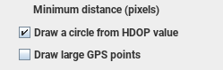
JOSM can show this information (just click the checkbox in the settings answered 18 Sep '17, 09:06 Hjart edited 18 Sep '17, 09:18 |
 ). I don't think any other editor can.
An observation. It doesn't pay to get too upset about absolute positioning of objects. I'm using 4 different imagery sources and keeping the OSM data properly aligned on all of them is making me crazy. If you have a bunch of GPS traces to adjust the offset that certainly helps but to be concerned about a point that, at best, has plus or minus 3-meter accuracy might give you ulcers. Just use the data that fits and ignore the points that fall out of alignment on the imagery of your choice. Unfortunately, our consumer grade equipment simply isn't all that accurate in the first place.
My 2 cents