why I can't see both a track and map under ? I am on "openstreetmap" where I imported a gpx file. I received the message from openstreetmap.org: loaded successfully with 173 out of a possible 173 points. You can view the trace here: "https://www.openstreetmap.org/user/acha85/traces/2479812". But when I open this link I see only the track, without map "under". what do I have to do ? I use firefox and windows 8 asked 18 Aug '17, 09:07 acha85 edited 18 Aug '17, 10:36 |
2 Answers:
This will work using iD Editor:
answered 18 Aug '17, 14:17 neuhausr edited 18 Aug '17, 14:20 |
This is one of your uploaded traces shown on OSM using GPS Prune. You cannot edit OSM with P answered 18 Aug '17, 16:24 andy mackey (18 Aug '17, 16:26) andy mackey You Will also need JAVA to run GPS Prune, but both Java and Prune are small. https://www.java.com/en/ (18 Aug '17, 16:31) andy mackey Both are free and don't come with other rubbish. (19 Aug '17, 08:01) andy mackey |
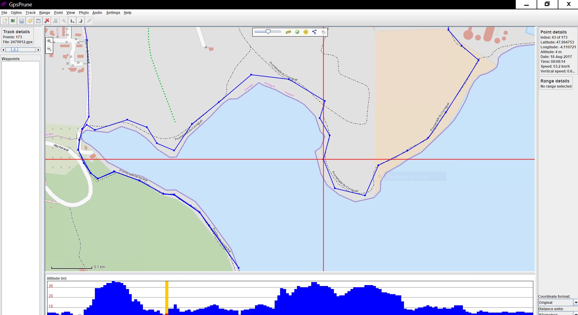 rune but you can check your trace against the map to decide if it is a worthwhile upload. Excess points can be deleted before uploading to OSM. I notice that your track might be more useful if track points were recorded more often, once a second is recommended.
Just to clarify, what website are you talking about here (assuming that you are talking about a website).
What have you done, and what did you expect to happen?
If you are trying to edit the map then tell us which editor you are using, iD JOSM or Potlatch2. The we can then explain how you can use your GPX trace. Have you uploaded it to OSM?
Excellent, i see you have uploaded a couple https://www.openstreetmap.org/user/acha85/traces
If you using JOSM to see the trace and after zooming in to reduce the area, next you need to click on the green down arrow to download the map data and download that as well.