For golf courses meaningful information in my opinion is: (1) Number (of tee or fairway or hole), (2) Par, (3) handicap for each fairway. I have seen spaces for these properties in a tag, but cannot find it again. None of the tags that I find under "golf features" contain these. How can I enter the information (1) through (3? asked 03 Jun '17, 20:32 maxwyss |
3 Answers:
The forms are tied to the type of feature being added. The
Once
answered 04 Jun '17, 13:41 maxerickson |
Hi is this a helpfull link ? https://wiki.openstreetmap.org/wiki/Tag:leisure%3Dgolf_course answered 03 Jun '17, 21:19 Hendrikklaas Thank you for the link. However, I have looked at this age already. It is useful for defining the several terms, very nice map. The problem is: The names defined in this figure do not all appear as a choice when mapping. I once found, but cannot find it again the tag "golf hole" (it is defined on the page you sent me to). Under this tag the most useful parameters were listed: Number, Par, handicap. That is my question: how do I get to this nice looking form where I can enter these parameters (number, par, handicap)? A related question: How can the tag "golf hole" appear on one day, but not on the next? Thanks for taking the trouble to consider my question. max (03 Jun '17, 21:30) maxwyss Which editor do you use ? You are always able to make and ad a tag (key and value) yourself, not everything is caught in a predefined menu. But remember to search for it in the wiki or the database. A newly used tag should get a page in the Wiki as well. Remember that golfcourses are mapped quit differently in OSM (03 Jun '17, 21:51) Hendrikklaas Thanks for expanding your answer. I us the iD editor. Do not know how to use a different one. I wish I could use JOSM, but this cannot be downloaded on my computer (windows 7), or can it? I have seen that I can add items in tags, however, (1) I do not want to add the same thing several times, and more importantly: (2) I do not want to reinvent the wheel. Someone had constructed a fine looking form containing spaces for "number, par, handicap", yet I cannot find it again on OSM. I have never used a different editor because I do not know why. So my question is still the same: where is that tag called "golf hole"? max (03 Jun '17, 22:02) maxwyss 1 Yes you can use josm on a win pc, it's a java program so you need to install java as well. search osm wiki for details. Note it is best to use comments to comment on your question, unless they are the answer to your original question. (04 Jun '17, 08:46) andy mackey (04 Jun '17, 08:49) andy mackey 1 I believe Josm does have golf preset so that would be useful for you. You can also create your own presets in Josm to suit you own preferences. (04 Jun '17, 12:55) nevw showing 5 of 6 show 1 more comments |
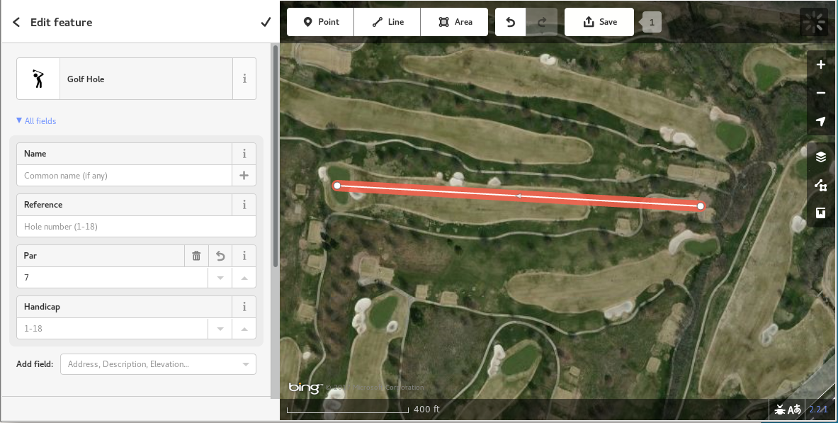
The other answers give helpful editor-specific information. In case it's helpful to see the actual tags for additional attributes for golf holes, here they are:
answered 05 Jun '17, 15:24 neuhausr edited 05 Jun '17, 17:06 Thanks, I saved this info. I see ref=and par= set as I fill out the line form. I guess I need to write the numbers interesting to a potential player in the title, then they will show on the map. I will do that and hoop it is acceptable. max (05 Jun '17, 16:55) maxwyss 4 Please don't make up text to put into the name/title just because it shows on a particular map. By putting the information into the specific tags, a given map rendering can easily choose whether to show them or not. Putting the information in the name so that it is shown on one particular map breaks this. This is a frequent discussion for OSM: https://wiki.openstreetmap.org/wiki/Tagging_for_the_renderer (05 Jun '17, 17:13) maxerickson |
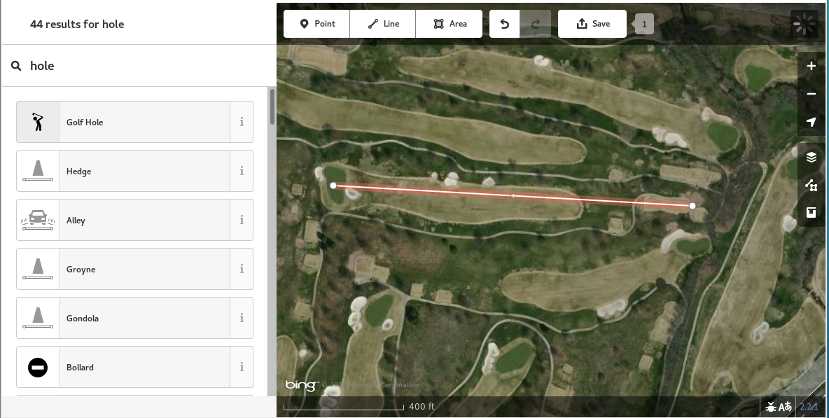
Thanks Andy, your answer helps. 1) I learned from you to use the comment button. I will do it. 2) Knowing that golf holes is a line item is a surprise form me, but it helps enormously. 3) I am trying to use JOSM, but have the same trouble as a question on the help page states: "not able to connect ...". Unfortunately I cannot figure out where I have an ABE file in my computer and how to change it, as the answer on the OSM page advises. Can you tell me what to do to get JOSM working? (windows 7) Thanks for considering the questions of a non-expert on computers max