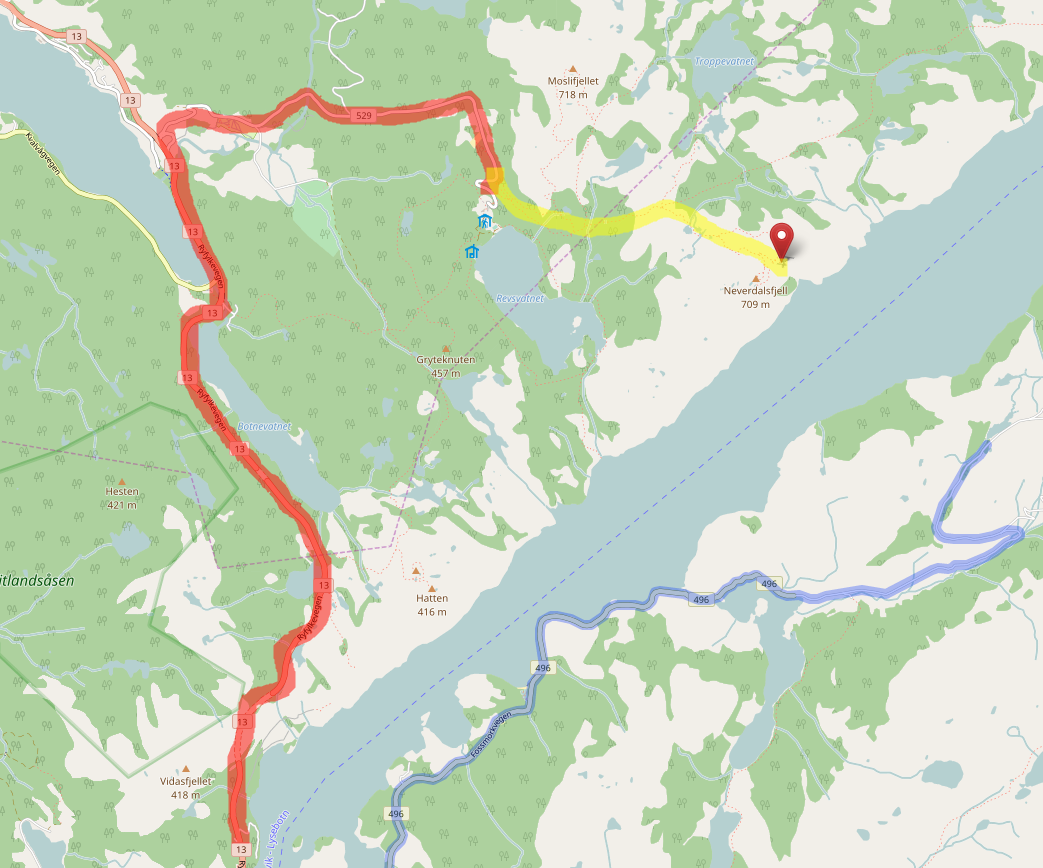
If one tries this routing from SVG airport to Preikestolen, a popular tourist attraction in Norway the router is very misleading. From this picture one can see that the router tries to navigate south of the fjord (marked in blue) and I marked the expected road in red marker and the expected footpath from there with yellow marker.
Is there a way to tag to help the router here? asked 04 May '17, 19:10 FredrikLindseth |
3 Answers:
The OSRM instance used by the Openstreetmap.org site only does vehicle routing. Since it looks like the end of the road on the south side is a bit closer to the destination than the end of the road on the north side, it's probably routing as close as it can by road and then leaving the rest up to the user to figure out. This leads to a wildly-incorrect result in this scenario as you've demonstrated. Unfortunately, I'm not sure there's anything that could be done to the tagging to fix OSRM's routing in this case. OSRM would need to be modified to be able to route on trails to get a more useful result. answered 04 May '17, 20:49 alester edited 04 May '17, 20:52 |
Currently all routers accessible via openstreetmap.org are restricted to one specific mode of transportation. If you want to use multiple modes of transportation then you have to calculate multiple individual routes. Example: Car route up to the nearest road of your destination, foot route from this road to your destination. To improve this behavior we have to improve the routing engines, not the map data. answered 05 May '17, 08:34 scai ♦ |
I agree with Alester answer. If you move the end marker only two hundred meters NW the route will be recalculated to your expected red route.. Initially I thought there was a problem with the mapping which i would have tested by doing this:- I would test it section by section by putting start( green) end (red) flags on smaller legs of the expected route. You should be able to pinpoint where the problem is. Next check for unconnected nodes, followed by Tags. Changing the routing choice between car, foot and bike may also give clues the problem, if it works for bike or foot the way could be connected ok but the ways do not allow cars, but that could be tagged correctly, that will need checking. answered 04 May '17, 22:41 andy mackey edited 04 May '17, 23:15 |