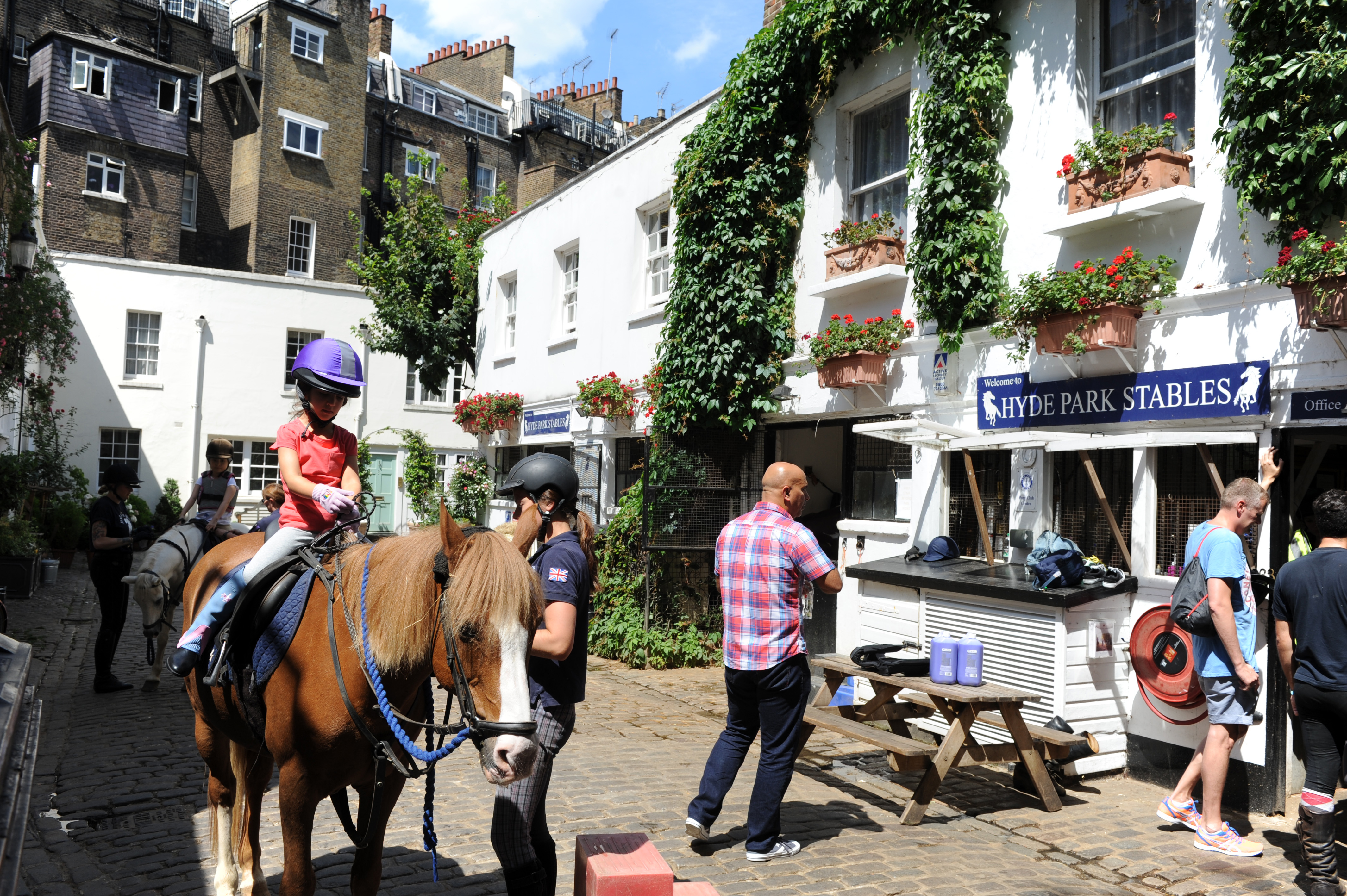
I would like to map a building which is a stables with 2 flats above. What's the best way of doing this? I was going to map the whole building as stables, and then use nodes for the 2 flats, but then you can't see what areas the flats cover. Is that the best way of doing it? Or should I do the stables and flats all as overlapping building ways? The stables are currently mapped as a node, but I don't like that as it doesn't show the whole area that the stables cover: https://www.openstreetmap.org/node/1011636463 You can see a photo here - the stables are on the ground floor and the 2 flats are the first floor. asked 01 May '17, 08:47 abeverley |
2 Answers:
I've heard that the building tag should reflect the style or type of the building, not the usage. E.g. we still map a church that is turned into lofts as building=church. This does not look to me like a typical stable, more like a residential building. But it has to be compared with the style of residential buildings in the area, if this is the case, map the building with building=residential The tag building:use can be added to reflect the current use. Since there are 2 uses in this case, you could add building:use=stable;residential If you want to add more detail, you can start thinking to using some aspects of indoor mapping. I would always keep the POI for the company operating the stables. answered 01 May '17, 11:01 escada |
Hi, you should not split a building so leave it just as building=yes. The users as stable and households should get a node with the special items as addresses and the use as stable with its special tags. There is a node stable but there seems to be no building, start adding the building and its neighbours and add the separate nodes to it the building with the stable inside, but don’t map for the renderer. By the way the whole Bathurst Mews seems likely to be residential as well and some building seems to be missing. answered 01 May '17, 10:53 Hendrikklaas edited 01 May '17, 10:59 |