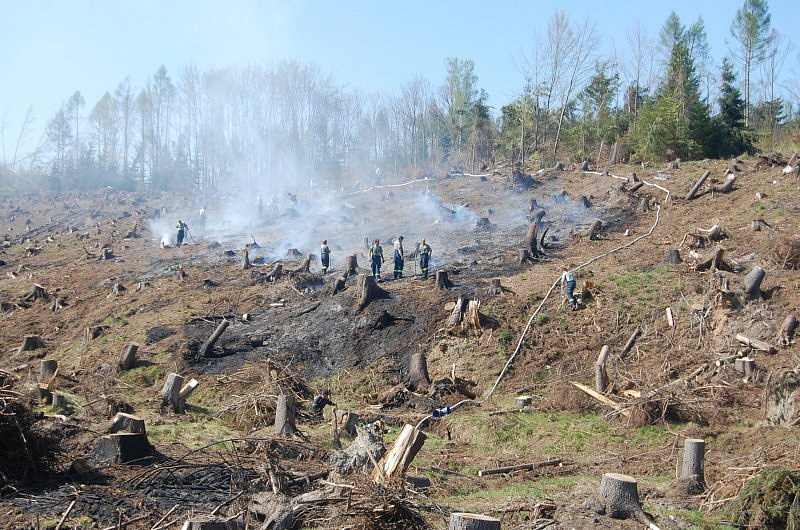
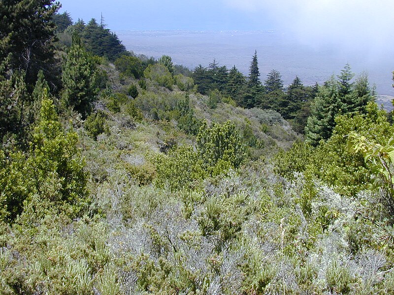
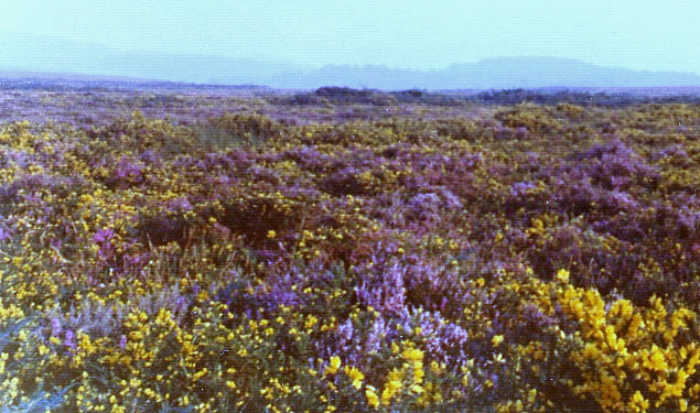
Glade is the place in forest after logging. It waits for some time and than new trees are planted there. (At least in Czechia) glade has usually quite regular shape - the forest is divided into rather regular seqments for purposes of logging and each of these segments is logged/planted etc separately. Glade looks like this Usually there are small trees planted at some point but it remains an open space for many years and is an important orientation place in a forest. I do not know how to tag, it because it is very different from meadow. Here is what it is not: It is NOT a meadowIt is very different from a meadow (landuse=meadow), at which no trees/Tree stumps/planted small trees are present. Also meadow is dominated by grass, glaze is not. Meadow looks like this It is NOT a scrubBecause usually there is no big bush cover. Scrub looks like this It is NOT heatI do not think it is a hear either. Glaze (mostly) does not contain any dwarf-shrub habitat neither any low growing woody vegetation. It is rare type of vegetation in Czechia.
Looking at the answers I see so far the problem is that probably the land surface of the glaze is not what is that important (it may be grass or earth) but rather the "land use". And again these places are very common and easily recognizable (even from aerial photos). asked 14 Mar '17, 12:48 gorn edited 15 Mar '17, 09:42 |
4 Answers:
What about natural=heath? That's supposed to be for "dwarf-shrub habitat, characterized by open, low growing woody vegetation". Or natural=grassland? Where "vegetation is dominated by grasses (Poaceae) and other herbaceous (non-woody) plants" Else it sounds like you're talking about bare earth (possibly covered with leaf litter or something) answered 14 Mar '17, 13:59 neuhausr |
I think you need a multipolygon. One polygon for the outside boundary of the forest and one for the clearing. The clearing could be tagged as neuhauser suggests "grassland" or "heath" or even "scrub". this question explains multipolygon procedure. https://help.openstreetmap.org/questions/34039/newbie-question-how-to-add-island-inside-lake answered 14 Mar '17, 23:38 andy mackey edited 14 Mar '17, 23:40 I am aware of multipolygons, but this was not a question. Please read the question which explains why the tags you are suggesting are not suitable. I have added pictures, to make it easier. (15 Mar '17, 09:31) gorn |
If it's not anything obvious, don't map it as anything specific. It's possible for renderers to do something useful with that. As an example, here is an area that's part of a forestry area that has no trees that isn't anything particular. A stand of a particular set of trees shows up in a different colour. Obviously tree/forest mapping is contentious, and this approach doesn't work with all ways of mapping forests. answered 15 Mar '17, 10:44 SomeoneElse ♦ |
Thanks for clarifying what you mean by "glade". What you picture is an area of forest that has been cut. There is an OSM tag for this: man_made=clearcut Just so you know, what you picture does not match well with the common English meaning of glade. To help understand the difference, see the glade and clearcutting pages on wikipedia. answered 15 Mar '17, 13:36 neuhausr |


Thanks for suggestion, but please read the question which explains why the tags you are suggesting are not suitable. I have added pictures, to make it easier.