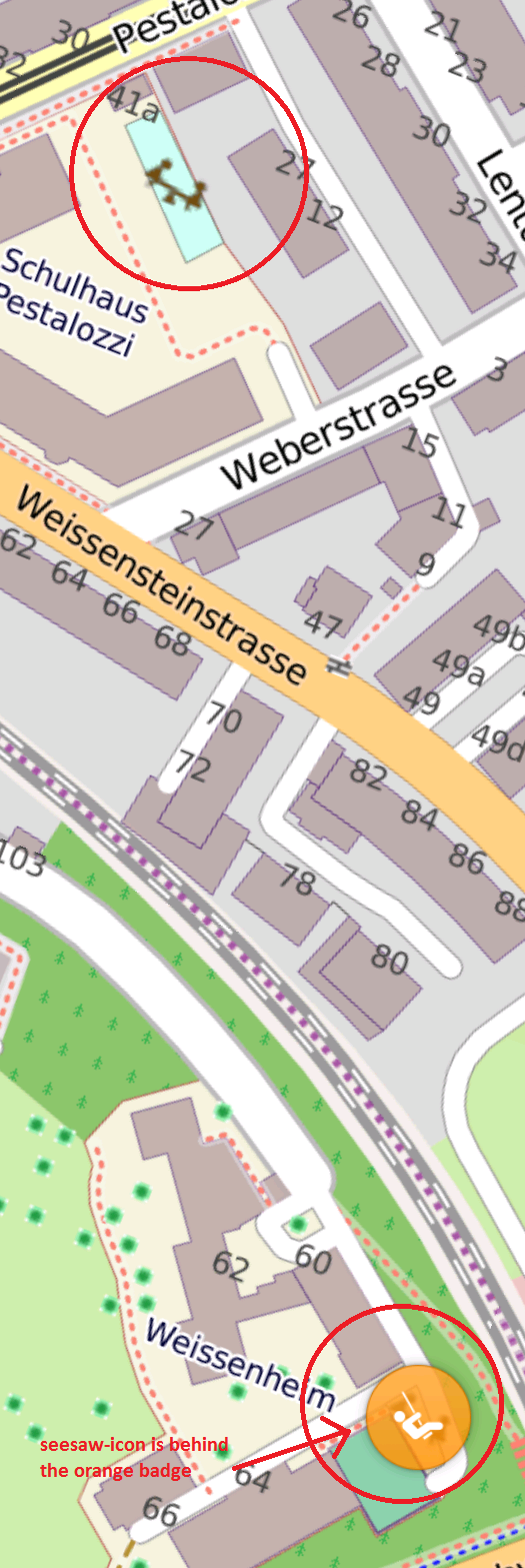
Hi, i added some playgrounds on openstreet map. The playgrounds which I added don't get the orange badge (compare to the playground at the bottom of the screenshot). In my opinion I added the same tags (leisure=playground). The behaviour is the same even if I change from polygon to point marker. Any ideas what I made wrong?
asked 19 Jan '17, 12:59 Baumeler edited 23 Jan '17, 20:28 aseerel4c26 ♦ showing 5 of 8 show 3 more comments |
One Answer:
It seems as if you are displaying raster map tiles from somewhere as a background in OsmAnd, -not- data directly rendered in OsmAnd. Your problem is simply that the OsmAnd map data you are using, and which is used to display the POI markers, doesn't contain the newly added playground yet. Verified with the current "official" OsmAnd map file for CH. Likely the OsmAnd map data from SOSM, see http://planet.osm.ch/ will show the POI. answered 19 Jan '17, 13:13 SimonPoole ♦ edited 19 Jan '17, 13:50 1 Thank you very much. This means I just have to wait. Will check again in a few weeks. (19 Jan '17, 15:11) Baumeler 1 Currently OsmAnd publishes new maps a few days after the start of each month. (19 Jan '17, 15:12) scai ♦ 2 SOSM generates a new map file for Switzerland daily. (19 Jan '17, 15:26) SimonPoole ♦ |
It would be helpful to paste the url from the address bar of the map you refer to here.
Thank you for the quick answers.
The screenshot is from the android application: osmAnd. I wonder why does OsmAnd show some POI-Playground-Areas with a badge and some without it.
The location on the web (without badges) https://www.openstreetmap.org/#map=18/46.93909/7.42625
I believe the "orange badge" is the result of a search in OsmAnd. Isn't it?
@H_miet: no.
Yes and no. You can search for playgrounds and choose to show all of them on the map. This will result in these orange markers.
@scai it still has nothing to do with the question
@scal how else do you get them?
By turning on POI display.