Hi I realise this is probably wishful thinking but... I'm looking for an alternative GPX editor to Basecamp. It has to be able to trim the GPX. One nice extra would be a direct upload to OSM, instead of exporting to my PC & then uploading via OSM's traces facility. Is there such a program? Cheers DaveF asked 18 Jan '17, 01:53 DaveF |
3 Answers:
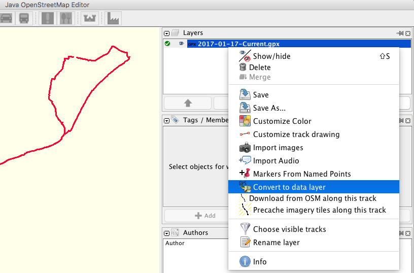
Josm allows you to edit a gpx. You load the gpx trace, right-click it in the layers window, convert to data layer, edit trace, right-click it in the layers window, convert to gpx layer (maybe export to gpx to over-write the original file).
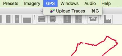
Prepare for editing osm: Right-click to customise the track colour and change the thickness in customise track drawing, and download from osm along the track, move the track above the osm data. You can now edit the map. If you download the 'DirectUpload Plugin' you can upload the gpx to osm (make the layer active first).
(OS X user) answered 18 Jan '17, 02:31 nevw edited 18 Jan '17, 12:28 |

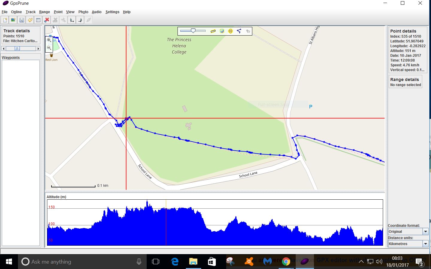
GPX Prune is a little JAVA app that will display the trace overlayed onto various OSM maps you can then delete points. its free it's here https://activityworkshop.net/software/gpsprune/ It cannot be used to directly upload a trace to OSM but is quicker and less cluttered than Basecamp and you can instantly see how your new trace compares to the current OSM data and if your new trace is a worthwhile upload. EDIT following DaveF's comment:-To remove one or several points, click on the point nearest to beginning that you wish to delete, hit "del" the cross hairs will advance to next point, "del"? and so on. For a larger number of points, such as a birds nest, click "track" menu Click "mark points in rectangle" draw rectangle then "del" removes them, made an error "undo" will give the restore option. There is a PDF manual available for 3 EUROs. at https://activityworkshop.net/software/gpsprune/how-tos.html
answered 18 Jan '17, 07:58 andy mackey edited 23 Jan '17, 13:44 |
Viking has features to upload and download your GPS Traces to OSM. Note that currently Viking doesn't yet support OAuth, so your password is transferred unencrypted in every request sent to the OpenStreetMap server using the basic authentication method. NB I have been tinkering with the source code trying to get OAuth working but unfortunately not quite there yet. answered 23 Jan '17, 00:54 robbieonsea |
I've been playing with GPSPrune for a couple of days now & seems to do what I want, except that when I 'delete range' it erases all the waypoints, even if they're not in that range. What am I missing?
Also, is there a quicker way to select a range start/end than using the pulldown menu? A convenient mouse/key combination maybe? If not it would be beneficial to have range start/end as a right click context menu option.
DaveF There isn't a quick short cut but the dropdowns work well with practice see edited answer, please.
To set range click on a track point: under range set start point: click on track at range end: set end point: if ok: hit delete Ok? if you delete in error, Tracks: undo then "yes" will put the point(s) back. The more I use this little app the more i like it.