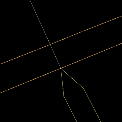
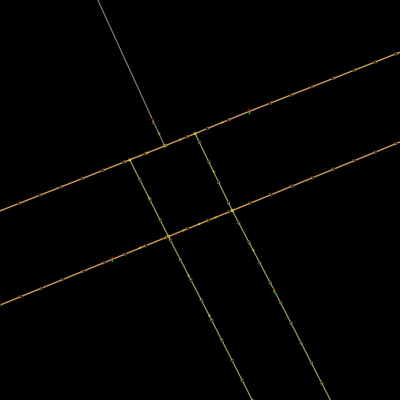
Greetings, Are there any guidelines to mapping an intersection where two divided highways meet and one terminates into a single undivided way with a different name? In my example below please assume the following:
Scenario 1: Join divided highway B before crossing A
Scenario 2: Join divided highway B after crossing A
Scenario 3: Never join divided highway B
asked 09 Oct '16, 07:47 CA Mapper edited 09 Oct '16, 13:04 aseerel4c26 ♦ |

One Answer:
Scenario 1 or 2 is most common, depending on whether there is still a traffic barrier for B in the intersection. Scenario 3 is a problem for turn by turn directions because a route passing through C-B or B-C will say something like "turn left followed by immediate right", and a left turn from A-C may say "turn left followed by an immediate left". answered 09 Oct '16, 12:46 Mike N |
If you have a specific intersection in mind, then it would be preferred that you give a satellite view to it so we can see the actual layout.
In general, from my experience of the type of junctions I have seen so far, I expect most would be best represented by scenario 2 and have a traffic signal tag on each line junction. Scenario 2 would appear to reflect the actual vehicle travel best.
On closer inspection of graphics above I see you have traffic lights located in preferred positions and agree with @Mike N that 1 & 2 are common and fine.