This question is very similar to this question, but asking about a different kind of flow / water level control mechanism.
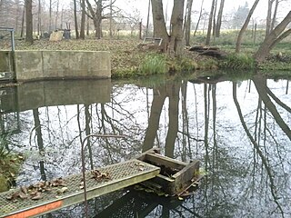
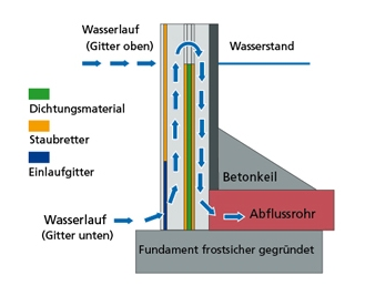
Managed ponds (especially those to used for fish farming) often have a water level control mechanism similar to a sluice gate that consists of a drain pipe with an adjustable height in a small case. I don't know what it is called in English, but in German and some other languages it is called "monk" (see e.g. German Wikipedia). What is the best way to tag these? asked 06 Aug '16, 08:46 moonrusha edited 06 Aug '16, 09:13 aseerel4c26 ♦ |
One Answer:
Unless you find something better, I would go for this:
But what about the tags In such rare tagging cases I like to add a answered 06 Aug '16, 09:25 aseerel4c26 ♦ |
The category of those images at Wikimedia Commons also has no English Name. Maybe none exists?