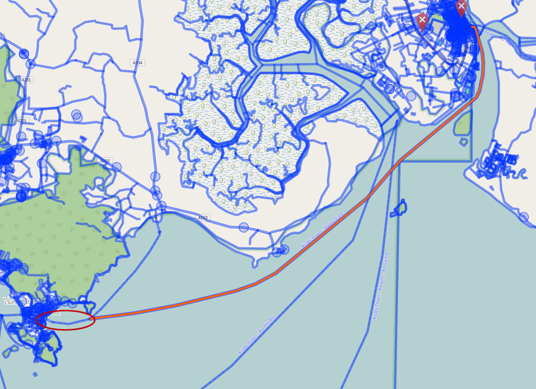
I'm messing around with OpenStreetMap and Overpass. Now I want to get information about routes. For example the ferry from Krabi to Railey East. It looks perfect on the map. The dotted ferry line goes from the harbor of Krabi to the harbor of Railey East. But when I click the route, only half lights up. Of course it makes sense. It connects to the other route. But how do I extract the whole route. How can I programmatic discover the start and the end point of a route? OSM data layer screenshot with highlighted area: asked 20 Jul '16, 23:47 NLAnaconda edited 02 Aug '16, 21:40 aseerel4c26 ♦ showing 5 of 6 show 1 more comments |
One Answer:
See our documentation wiki about Tag:route=ferry "connect each end of the ferry route to a way on land". So you should be able to
However, the wiki is no law book, and things may have been mapped differently in reality. So, in your example case way 130768455: this is not a mapping which is like the documentation describes. The western end is in the sea at an Y point. Here you would need to find other ways sharing the same end node and continue your imaginary travel through them (routing algorithms if you search a short travel). To find locations which can be reaches from node 2465989873 you would need to look which ways or relations with route=ferry tags the node is a member of and then find your way until (routing algorithms if you search a short one) you reach land (different for ways or relations and different depending if routes have been mapped not land-to-land – as said before). answered 02 Aug '16, 21:23 aseerel4c26 ♦ edited 02 Aug '16, 21:47 Thanks for pointing me in the right direction! (02 Aug '16, 22:12) NLAnaconda @NLAnaconda: thanks for the feedback! :-) Glad to help. (02 Aug '16, 22:14) aseerel4c26 ♦ |
cross-posted: https://stackoverflow.com/questions/38579137/osm-how-to-get-the-start-and-the-endpoint-of-a-route
when you say "Overpass" you likely mean (at least for the "click" part) Overpass API's interface "Overpass Turbo".
Yes I do. :)
I do not know which specific ferry route you are talking about. Could you please provide the OSM object id/link or at least location?
It is this route: https://www.openstreetmap.org/way/130768455 Actually what I want to achieve is to know what destinations can be reached from a harbor (in this case: node 2465989873)
meta: In general, please do not post your questions to several places. That wastes help resources. If you really need to (for whatever reason), please always mentioning it in each post and provide links to the other posts. Once you've got an answer at one place, update all the other places.