Hi there, I am a gpx track that wanders across Europe from Gibraltar to North cape in Norway and want to download the relevant OSM tiles to use with it on my 60Csx. Rather than just guessing which tiles I need on http://garmin.openstreetmap.nl/, can I somehow view the GPX superimposed on the tile selection map so I can get all the right ones first time? All the best John asked 03 Jun '16, 10:32 redballrun edited 12 Jan '17, 22:30 aseerel4c26 ♦ |
5 Answers:
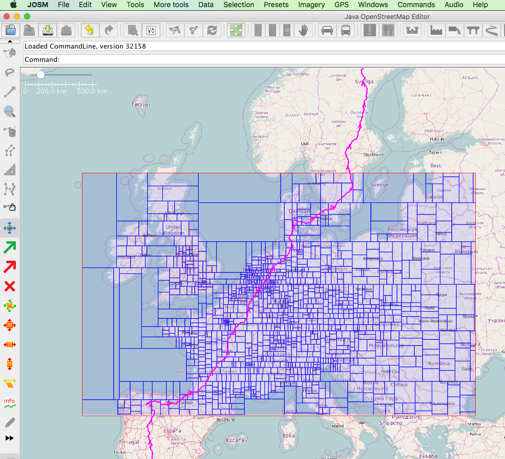
Here is another alternative... In JOSM, load the 'pic layer' plugin and restart. It should look something like this... Then load other screen shots to complete the route and you should be able to select just the tiles you need, by alternating between JOSM and your browser to select them, and hopefully eventually have one suitable map for the Garmin. But I think that Andy Mackey has suggested the best method by loading all Europe and use Basecamp to sent just the portion required to you gps receiver. I haven't done that myself but it would seem to be the easiest. answered 08 Jun '16, 11:46 nevw edited 08 Jun '16, 12:45 |


answered 03 Jun '16, 18:48 andy mackey edited 03 Jun '16, 19:10 http://www.openfietsmap.nl/ do a single map of Europe in seems. That may work for you, but you may find that a micro sd that big isn't readable on your garmin. Basecamp however will export the bits you want to the GPS60csx. This will give maps on a consistent rendering style for the whole route. You will have to do some tests, Please let us know what works for you. (03 Jun '16, 19:28) andy mackey I've just downloaded and installed a map that covers Southern half of France, all of Portugal and all of Spain ( from http://www.openfietsmap.nl/) I'm suprised its only 1.5 gb and works fine in Basecamp and a Vista HCX. I downloaded this for a fellow walker who is off to Spain next week. We usually get an OSM for his Garmin GPS60 working before he travels. He has been impressed with She Lanka and then India maps previously. (08 Jun '16, 14:37) andy mackey continued.. if you downloaded three or four more .img files on to micro sd cards they would cover the whole route Norway to Gibraltar and you could swap them as required. They could then also be used for any route you wish to take in much of western Europe. (08 Jun '16, 22:51) andy mackey |
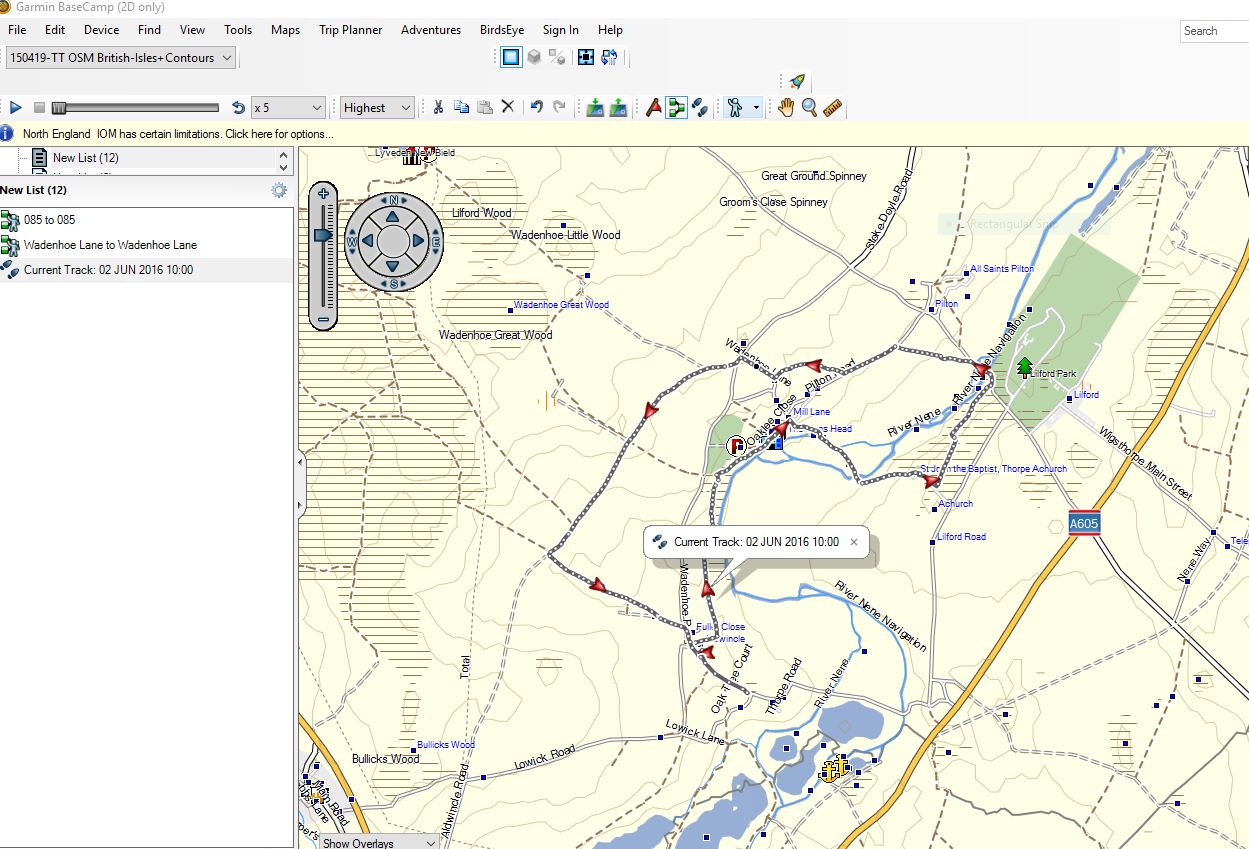 The Garmin GPS60 csx will display one of these osm maps
 Try http://www.reta-vortaro.de/garmin/ it's http://garmin.openstreetmap.nl/ plus showing gpx- or kml-tracks. I hope, this will be merged soon. answered 11 Jan '17, 22:38 wieland Is that useful in that it still seems to be still using the same back-end servers and reports "Server Status - Disk full"? (11 Jan '17, 22:48) SomeoneElse ♦ 1 Wieland - spectacular reply! I'll check it out tonight (12 Jan '17, 12:29) bfgjohno 1 It's just a modified copy of the front-end. So the back-end is the same and has the same status. (12 Jan '17, 16:11) wieland A similar test-track like in the question is http://www.reta-vortaro.de/garmin/Nordkap2Gibraltar.kml (12 Jan '17, 16:14) wieland Added that HTTPS and URL-parameters should work. Let me know. (27 Dec '17, 21:42) wieland |
Hi, since the wandelmap (http://www.openwandelkaart.nl/) is in a Beta version and only shows the Benelux, I would go for the Opencycle version (http://www.openfietsmap.nl/downloads/europe) and load the different sets of maps and store them on a large micro memory chip. Or load them on a stick and carry them along to store them on your GSM on the way. But have a look at all variations and take a pick, the cycle map shows even a path through a natural area, so good enough without a huge amount of different maps. answered 03 Jun '16, 11:48 Hendrikklaas 3 I think that you've got hold of the wrong end of the stick here - it sounds as if the questioner is asking about how to select the "tiles" used by http://garmin.openstreetmap.nl/ based on a GPX they have. Pointing them at a Benelux map or an all-Europe download won't actually answer that question. (03 Jun '16, 12:19) SomeoneElse ♦ 1 Thanks for the reply Hendrikklaas but it's as SoemoneElse says. Good to knoew people are reading the forum though. (03 Jun '16, 12:37) redballrun |
You could load the gpx file into JOSM and then right-click on the gpx listed in the layers box and download osm data along the track. You can choose to save data within about 100m or so of the track and then JOSM chooses to load blocks of data that it finds to be most efficient size to transfer. Save the osm layer to your hard drive and then use the Mkgmap program to convert the saved .osm file to a garmin suitable gmapsupp.img file to load into the 60Csx. In JOSM, you can instead wander along the gpx track and choose the blocks of data yourself if you wish to limit the final file size. answered 03 Jun '16, 15:15 nevw 1 You'd then need to combine the .osm data you get that way into a large .osm, run "splitter" on that and then run "mkgmap" yourself though I think? Unless there's some functionality of JOSM that I'm unaware of, of course. (03 Jun '16, 15:23) SomeoneElse ♦ 1 After loading the sections into the same layer, josm should save as one osm file I believe. The rest is done outside of josm, using mkgmap and would for all but small areas, also include using the splitter. (03 Jun '16, 16:09) nevw 1 Tried JOSM but the amount od data downloaded is immense and seemed to overwhelm my Mac! Is another way to download what I think are the correct tiles from garmin.openstreetmap.nl and somehow add my gpx as a layer onto this, combine the two then identify missing tiles, download them and use OSM Combiner?? Is thera way of turning my GPX into a map layer and combining it with the downloaded tiles? (07 Jun '16, 15:39) redballrun 1 @Wieland - I've tried your page and really like it BUT the circle of doom never finishes looping to allow me to enter my e-mail address and request the map (17 Jan '17, 18:48) bfgjohno You are right. I played around and put in a typo. Try again (you need to reload the page). (17 Jan '17, 22:44) wieland showing 5 of 6 show 1 more comments |
Thanks nevw