NOTICE: help.openstreetmap.org is no longer in use from 1st March 2024. Please use the OpenStreetMap Community Forum

I'm trying to render some data in a .osm file, mainly for debugging purposes at this stage, but it will become a proper overlay.

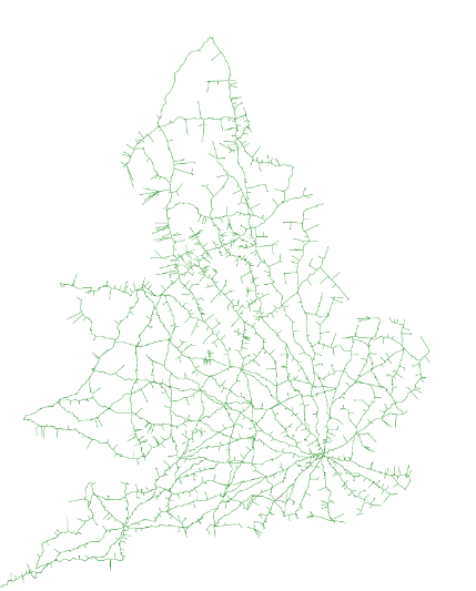
I'm using this generate_image.py script and defining a simple XML stylesheet, which results in this .png file (screenshotted as follows), which all looks correct (and the .osm file is routable in OSRM too) :

alt text

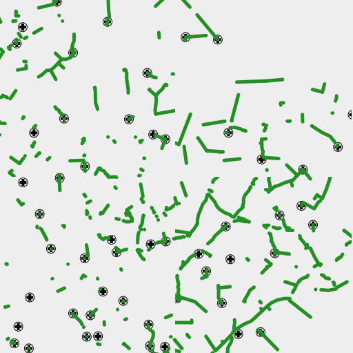
However, if I use this generate_tiles.py script to generate a tile tree (instead of the single .png file as above), only fragments of the ways are shown, in an inconsistent and fragmented form, shown here zoomed into level 12 or so:

alt text

The OSRM routing when zoomed in at this level does follow those line fragments exactly, but obviously goes further than the extent of each fragment.

It's not a browser caching issue - creating a fresh tileset, and creating an incognito instance (which bypasses the cache) gives the same. When I zoom in, different fragments of the ways are shown.

Is this likely to be a projection issue? As far as I can see, it's all set to Google Mercator.

Any other ideas what might be causing this problem? I've been fiddling with this for a day or two now and stuck!

asked 10 May '16, 19:48

fooquency's gravatar image

fooquency
765610
accept rate: 0%

edited 11 May '16, 22:29

aseerel4c26's gravatar image

aseerel4c26 ♦
32.6k18248554


In general I recommend avoiding the OSM input plugin - use osm2pgsql or convert the osm file to shapefiles first. The OSM input plugin is effectively unmaintained.

My only other suggestion would be to check the clip setting in your LineSymbolizer (or line-clip if you are using CartoCSS).

permanent link

answered 11 May '16, 11:05

Andy%20Allan's gravatar image

Andy Allan
12.5k23128153
accept rate: 28%

Your answer
toggle preview

Follow this question

By Email:

Once you sign in you will be able to subscribe for any updates here

By RSS:

Answers

Answers and Comments

Markdown Basics

  • *italic* or _italic_
  • **bold** or __bold__
  • link:[text](http://url.com/ "title")
  • image?![alt text](/path/img.jpg "title")
  • numbered list: 1. Foo 2. Bar
  • to add a line break simply add two spaces to where you would like the new line to be.
  • basic HTML tags are also supported

Question tags:

×440
×341
×20

question asked: 10 May '16, 19:48

question was seen: 2,705 times

last updated: 11 May '16, 22:29

NOTICE: help.openstreetmap.org is no longer in use from 1st March 2024. Please use the OpenStreetMap Community Forum