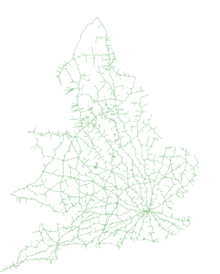
I'm trying to render some data in a .osm file, mainly for debugging purposes at this stage, but it will become a proper overlay. I'm using this
However, if I use this
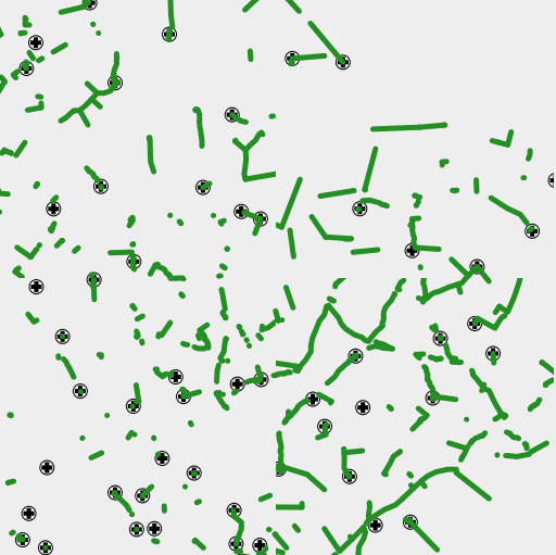
The OSRM routing when zoomed in at this level does follow those line fragments exactly, but obviously goes further than the extent of each fragment. It's not a browser caching issue - creating a fresh tileset, and creating an incognito instance (which bypasses the cache) gives the same. When I zoom in, different fragments of the ways are shown. Is this likely to be a projection issue? As far as I can see, it's all set to Google Mercator. Any other ideas what might be causing this problem? I've been fiddling with this for a day or two now and stuck! asked 10 May '16, 19:48 fooquency edited 11 May '16, 22:29 aseerel4c26 ♦ |
One Answer:
In general I recommend avoiding the OSM input plugin - use osm2pgsql or convert the osm file to shapefiles first. The OSM input plugin is effectively unmaintained. My only other suggestion would be to check the answered 11 May '16, 11:05 Andy Allan |