Hi! I was about to do my first edits (add a few sidewalks), but when switched to edit I noticed that my whole neighborhood has offset comparing to aerial imagery. Here you can clearly see that road didn't match itself, offset is about 5 meters – https://www.openstreetmap.org/edit#map=18/59.68428/30.43226 What should i do? Draw my sidewalks ignoring mismatch? asked 29 Oct '15, 22:54 H1D edited 30 Oct '15, 05:58 aseerel4c26 ♦ |
2 Answers:
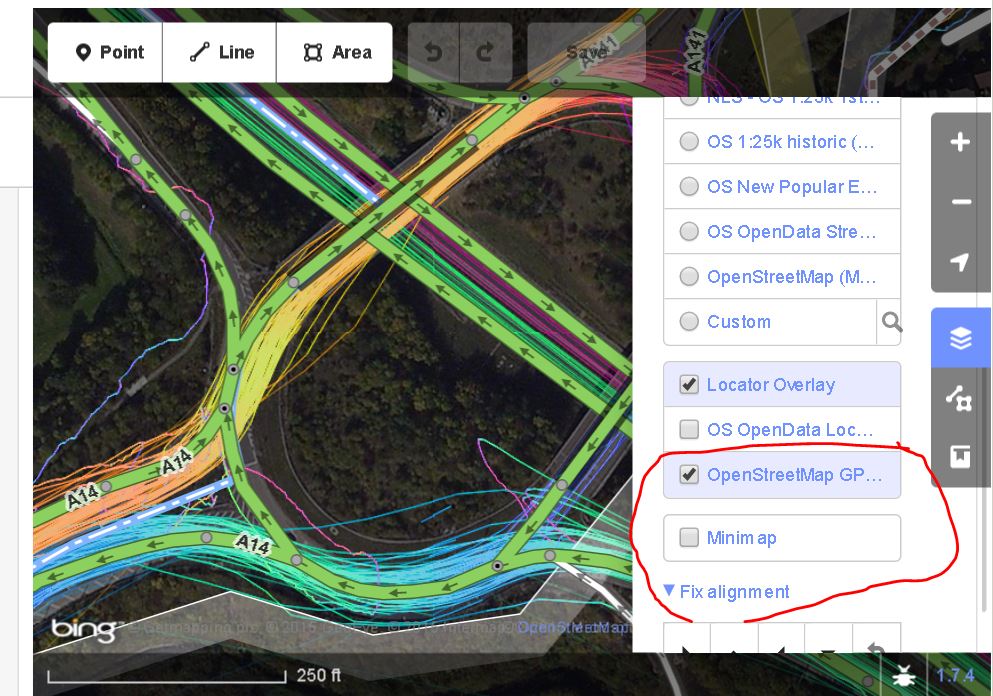
Hi, welcome to OSM! Either the aerial imagery is at a wrong position or the current OSM data (if people forgot/did not have the sources for enough alignment) or both. You should try to find out by also looking at gps traces (there are many already uploaded in your area). If you are unsure, please align the aerial imagery (all our editors offer this feature) to fit the pre-existing OSM data in this area and then start to do your new sidewalks. See https://wiki.openstreetmap.org/wiki/Good_practice#Align_Aerial_Imagery_before_Tracing (section "Align Aerial Imagery before Tracing") . Or bing-osm-and-my-waypoints-all-misaligned-who-do-i-trust or aligning-roads-to-proper-location or alignment-of-track-vs-background-imagery and more older questions here on this site. answered 30 Oct '15, 06:09 aseerel4c26 ♦ edited 30 Oct '15, 06:16 |
answered 30 Oct '15, 11:06 andy mackey edited 30 Oct '15, 19:04 aseerel4c26 ♦ 1 From looking at edits in the linked area https://www.openstreetmap.org/history#map=19/59.68370/30.43174 I think that the person asking the question's using iD, so the screenshot above should help. (30 Oct '15, 12:13) SomeoneElse ♦ |
 In addition to aseerel4c26's answer. In potlatch2 i looked at all the traces and bing which showed that of the two roads running north to south the west one is correct but the east one is a little off. the east to west road looks ok and the buildings are also ok when Bing is re-aligned.
(semi-offtopic) By the way: note, that it may be more useful to map sidewalks "as refinement to a highway" object, so you do not need to "draw" new object if you want to add sidewalk information.