Is the software capable to point out for example all the points that surround a city where the travelling time is less than 10 minutes, or 15 minute, or so on, based on the speed limits that are inserted for each type of road? asked 24 Sep '15, 13:26 Adela-Ioana ... |
2 Answers:
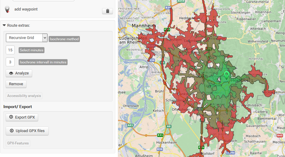
OpenRouteService.org offers such an Accessibility Analysis service. I don't know exactly what OSM tags are taken into account for the analysis. Maybe you want to check their website for details.
answered 24 Sep '15, 14:53 mmd Thank you for your response. I have previously tried to play with OpenRouteService. Do you know if I can insert here different points at the same time and calculate their isochromes? I am intersted in the areas where it will be time consuming to get access, no matter which will be the starting point. (24 Sep '15, 15:02) Adela-Ioana ... 1 I don't think it is possible to run the analysis for several points in one run. The web service returns some embedded GML for different areas. Maybe you can run several queries, extract the GML portions you're interested in and intersect the areas manually in QGis as an example. (24 Sep '15, 15:24) mmd 1 Please read their contact page carefully, as you are not supposed to run queries during extended periods. (24 Sep '15, 16:58) escada |
There is a whole page about isochrones in our wiki listing various examples and software solutions. answered 24 Sep '15, 15:13 scai ♦ |
Are you asking about any particular software?
OpenStreetMap is essentially lots and lots of data which you can download and process yourself. People write software (for example, the online routing tools that you see on "openstreetmap.org") using this data.
If you could describe in a few more words what you're trying to do it would help.
I am reffering to OpenStreetMap and if it allows the users to built some kind of isochromes.