Hi, in my locality users have started mapping very small electoral wards as low level admin boundaries. This is beginning to clutter the map as there are now boundary lines everywhere, obscuring other data. Is it possible to download a program/patch to allow me to "switch off" these low level boundaries, or any other osm features? thanks oooooandy asked 21 Apr '15, 06:05 OOOOOandy |
2 Answers:
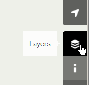
On the OSM website there are five different layers available:
All of the layers other than "standard" have less prominent admin boundaries; some have no admin boundaries at all. answered 21 Apr '15, 10:13 SomeoneElse ♦ edited 21 Apr '15, 22:21 |
JOSM has the possibility to filter out features. You could either dim them or make them completely invisible. This works very good for unconnected features. This might give problems when the boundaries are attached to roads and you start moving the nodes of the road. There is e.g. a Mapbox blox on this topic. And the JOSM Wiki Documentation on filters. A simple filter "boundary" (without the quotes) would already allow you to filter out all boundaries (all levels) answered 21 Apr '15, 07:48 escada |
Not an answer to your query, but this site may help to highlight the ones you wish to see http://layers.openstreetmap.fr/
One other consideration: even if you find a way to filter them out for you, it'll be cluttering things up for others. Soemtimes it's good to ask yourself if OSM is the best place for certain data.
I agree, but there's nothing I can do about that, this group of people have decided to add these features.