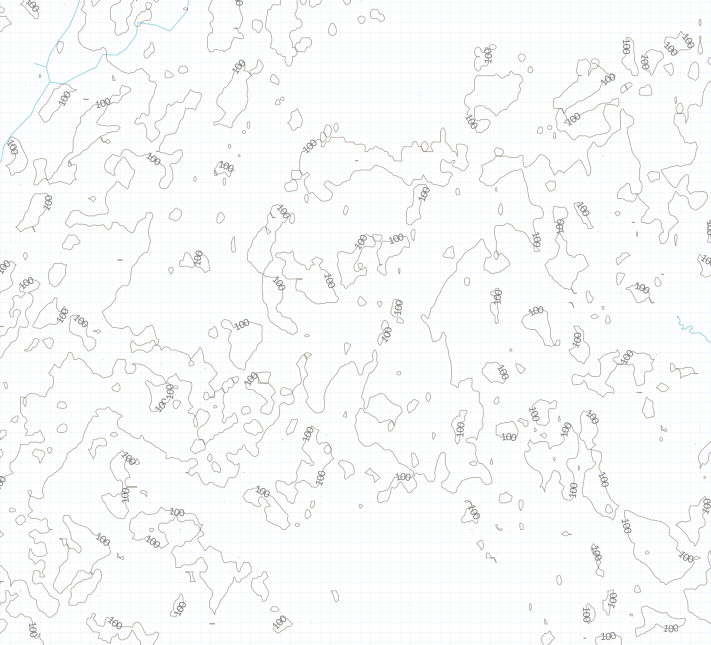
When I make contours layer (with gdal_contour) for my area (near 60°N), the result is quite messy and not usable. See the image below for an example. Can I fix this, and how? Sorry that this question does not relate to OSM directly, but such artifats are visible on most OSM tiles that use SRTM data, such as CycleMap.
asked 19 Apr '14, 21:44 Zverik closed 21 Apr '14, 21:10 |
The question has been closed for the following reason “The question is answered, right answer was accepted” by Zverik 21 Apr ‘14, 21:10
2 Answers:
Looks like this area is rather flat. A few things can help: Render the contour lines with a less proeminent style: lighter, thinner. Contour lines are arbitrary and artificial, so they will look strange if they are as visible as the other map features. Decrease resolution of the DEM raster, or smooth them with a median filter 3x3 or 5x5 (very useful for Aster). You loose accuracy, but the map is more readable. Smooth the contour lines with Bezier curves (mapnik smooth parameter). answered 20 Apr '14, 07:33 yvecai |
Solved this by downloading GMTED2010 dataset and applying "Grid → Gaussian Filter" with SAGA (radius 2). Applying "Simple Filter" with radius 8 on SRTM also worked, though GMTED has better coverage in northern regions. answered 21 Apr '14, 21:08 Zverik edited 21 Apr '14, 21:09 |