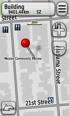
I am trying to figure out how to use US maps in the city, especially display of buildings on my Garmin Oregon 450. First I tried maps from http://daveh.dev.openstreetmap.org/garmin/Lambertus/ which does not seem to display any buildings although this was early in my investigation so I can be wrong here. Then I downloaded complete map of the US from osmmaps.com and experimented a bit. I realized that the display of the buildings depends on the active profile. Here are screenshots of the same area with different profiles. Here is the Automobile profile:
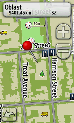
and here is the Recreation profile:
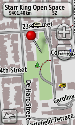
and here is the Fitness profile which interestingly looks like the Automobile profile, at least in terms of buildings:
and finally Geocaching profile which I use most:
Each of the profiles has the same settings of maps (map selection, level of detail). I can see that the buildings are there even on the last Recreation and Geocaching profiles however on the GPS screen itself the soft and bleak colors make it absolutely invisible (the above are screenshots taken with the Screen Capture feature of the GPS). I have also tried with maps generated from http://garmin.openstreetmap.nl and the effect is the same. The interesting thing is that I have no problem with maps of Czech republic generated from http://garmin.openstreetmap.cz/ as the buildings are displayed just fine even in Geocaching profiles. Has anybody encountered the same problem ? I did not find any way how to modify this kind of detailed setting anywhere in the GPS Setup menu. It seems that the profiles can be only cloned. Or maybe there is some better forum to ask this question ? update 10/2014: I tried this again (with Geocaching profile) and found out that so far the best is Generic with TYP file. new style:
generic:
generic with TYP:
asked 11 Sep '13, 14:21 VladaK edited 31 Oct '14, 17:04 aseerel4c26 ♦ |


2 Answers:
It depends if the maps use a TYP file or not. Without a typ file, buildings are almost invisible on most garmin devices, maybe except older ones. Try the generic new maps from http://garmin.openstreetmap.nl/ it uses a typ file, or use the old/default style with mapnik typ file included. answered 23 Oct '14, 06:54 ligfietser |
The map display may be set up differently in each profile. You can change it in any one profile, when in that profile, by selecting:- setup: map: advanced map Setup: you then have four options, all will modify how a map is displayed, BUT I suggest Detail: Most.... See if that works. The Czech map is probably created with a different rendering style and that makes it look sharper. answered 22 Oct '14, 22:45 andy mackey edited 22 Oct '14, 22:54 |