I am beginner. I would like to display few GPS coordinates on OSM. For example: How can I do it? asked 08 May '12, 20:37 EKL edited 24 Feb '15, 15:09 aseerel4c26 ♦ |
5 Answers:
If you right click permalink tab on the map page and then copy link address and then paste it you will get something like this. I have substituted your first pair of co-ords and it seems to work. https://www.openstreetmap.org/?lat=50.1373102630358&lon=%2014.4652336835861&zoom=17&layers=M also if you click on edit (potlach2) and sign in then click on options and one tick box offers to show mouse pointer lat log which may be of use
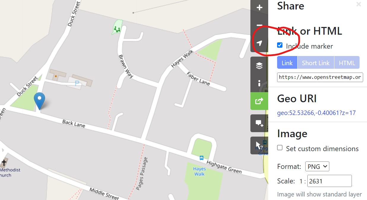
answered 08 May '12, 21:40 andy mackey edited 05 Mar '22, 07:54 Andy, how to display a marker in openstreetmap using those coordinates or url (https://www.openstreetmap.org/?lat=50.1373102630358&lon=%2014.4652336835861&zoom=17&layers=M). I want to view it with a marker. (05 Mar '22, 02:39) cybercrimeco... Tick the box for marker. see added jpeg (05 Mar '22, 07:54) andy mackey |
@cendonuser If you select the direction arrows next to the search bar and drag the green marker to the osm the coords will appear in the 'from' box. You can drag the marker around the map to find other coords. answered 24 Feb '15, 14:17 nevw edited 24 Feb '15, 14:25 |
You can use uMap for that. You can create a new map, and then you can import data as CSV, so for your example: NB: I've added a third column to give a "description" to markers. answered 24 Feb '15, 14:48 NicolasDumoulin |
You mean that you want to display a marker for these coordinates? If so, please read this other question. answered 08 May '12, 21:57 NicolasDumoulin |
If you paste a pair of the coordinates into the osm, 50.1373102630358, 14.4652336835861 you get answered 24 Feb '15, 14:01 nevw edited 24 Feb '15, 14:05 |
If he meant "when I click on a point on the map I would like to be shown that point's coordinates just as it happens in the updated google maps" I would like the same and don't know how to do it.